Data & Sensing for Industry
Persistent, high-resolution aerial data for commercial and industrial applications. Our stratospheric platform delivers the coverage of satellites with the detail of aircraft—at a fraction of the cost.
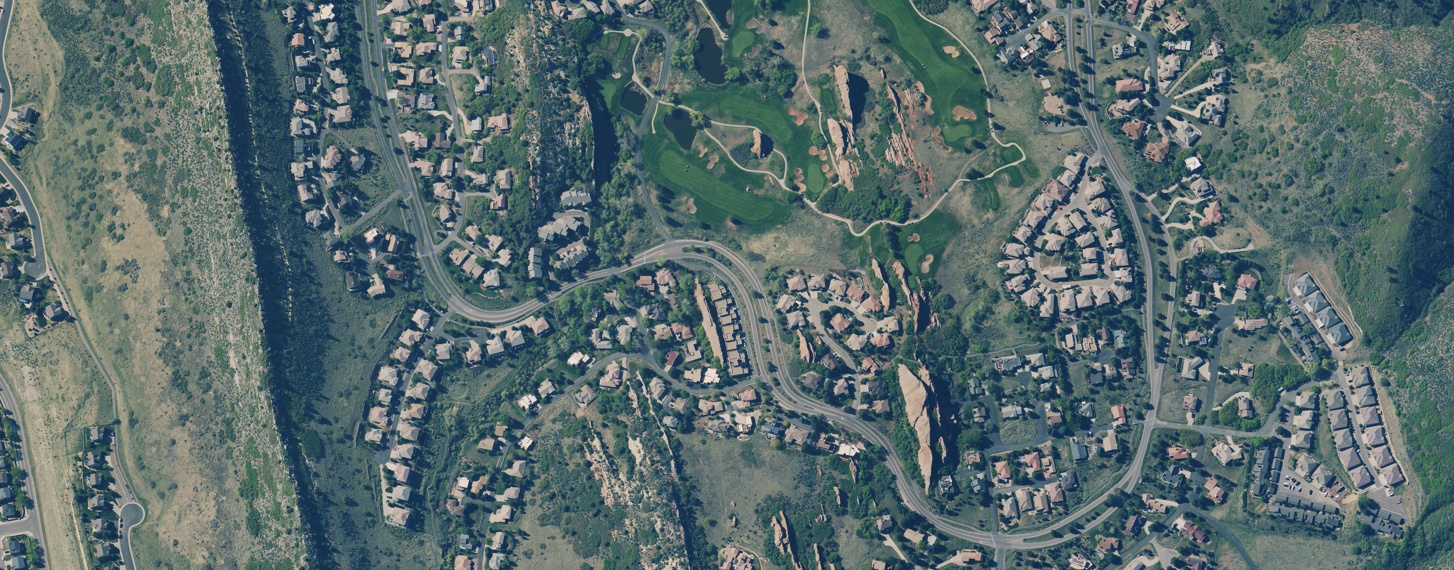
Residential community mapping — individual structures clearly visible
Cost Effective
Fraction of satellite or manned aircraft costs for comparable coverage.
Rapid Tasking
Deploy within hours, not weeks like traditional satellite systems.
Persistent Coverage
Multi-day missions provide continuous monitoring capability.
High Resolution
10cm optical resolution exceeds most satellite imagery.
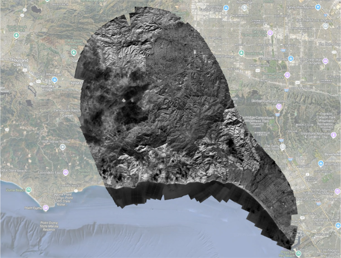
Disaster Response Mapping
During the Palisades Fire, our stratospheric platform provided critical situational awareness to emergency responders. Persistent coverage enabled real-time fire perimeter tracking and damage assessment where smoke obscured satellite and aircraft imagery.
- • Continuous coverage through smoke and adverse conditions
- • Real-time data delivery to incident commanders
- • Rapid deployment to emerging incidents
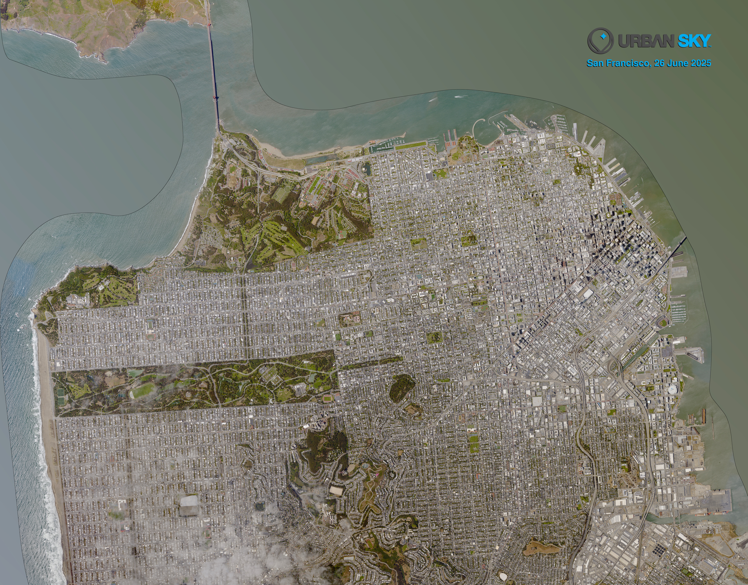
Wide-Area Coverage with Unprecedented Detail
Our stratospheric platform captures expansive areas with resolution that rivals low-altitude aircraft. This San Francisco image demonstrates our ability to monitor entire metropolitan regions while maintaining the detail needed for infrastructure assessment and change detection.
- • 80cm resolution across wide coverage areas
- • Multi-day persistent surveillance capability
- • Ideal for urban planning and infrastructure monitoring
Commercial Applications
Our platform supports a wide range of commercial and industrial use cases.
Urban & City Monitoring
The freshest, high-resolution data to map change over large urban centers and metropolitan areas.
- Change detection
- Urban planning
- Development tracking
Disaster Response
Rapid situational awareness over wildfires, floods, and emergencies when it matters most.
- Fire perimeter tracking
- Flood plain monitoring
- Damage assessment
Infrastructure
Monitor pipelines, power lines, and distributed assets across vast areas cost-effectively.
- Utility inspection
- Pipeline monitoring
- Oil & gas assets
Agriculture
Understand and manage crop production and vegetation health at scale.
- Crop health analysis
- Yield prediction
- Irrigation planning
Insurance & Risk
Accurate property assessment, claims verification, and risk modeling with current imagery.
- Property assessment
- Claims verification
- Risk modeling
Environmental & Climate
Track environmental changes, monitor natural resources, and observe climate indicators.
- Climate monitoring
- Deforestation tracking
- Remote area surveys
Ready to Get Started?
Contact us to discuss your data requirements and explore pricing options.
Request Quote